








Defense Mission Planning System
Anemos X
In modern military airlift operations, every mission depends on precision, speed and absolute control. That’s why we built Anemos X — an advanced flight‑planning ecosystem originally engineered for commercial airlines, now optimized for the demanding world of defense aviation.
Anemos X brings together mission planning, runway performance calculation and real‑time flight following in one unified platform. It deploys seamlessly across cloud, hybrid or fully on‑premise environments, ensuring mission‑critical data stays exactly where it belongs — inside your infrastructure, shielded from external access.
Secure Mission Planning for Military Transport Operations
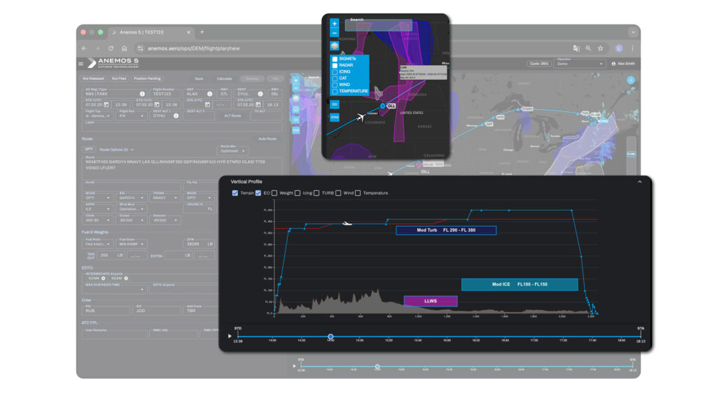
Vertical Profile & Weather Awareness
The Vertical Profile provides a comprehensive depiction of the planned and actual flight path, including own‑ship position, routing points and integrated meteorological layers to enhance situational awareness. Turbulence, icing conditions, SIGMETs, weather radar, terrain data, and OEM‑validated engine-out performance information are fused to support mission planning, threat mitigation and informed tactical decision‑making.
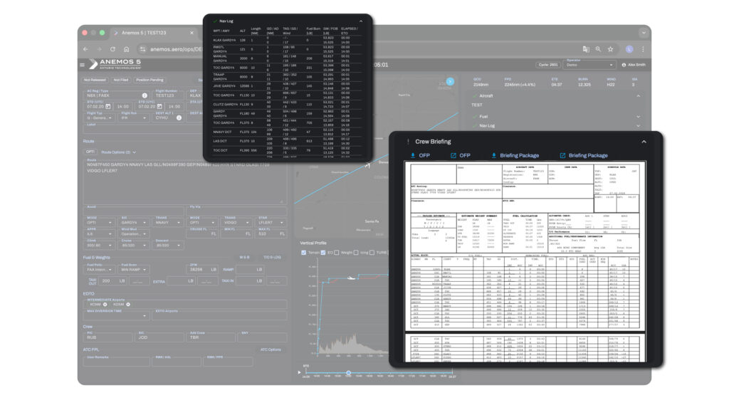
Navlog & Crew Briefing Overview
The Navlog module delivers flight levels, leg distances, fuel consumption, wind and temperature data and aircraft weight information in a standardized and mission‑oriented format. A complete crew briefing is generated automatically, while the configurable Operational Flight Plan (OFP) and briefing package can be accessed independently and are made available in the Anemos EFB mobile application upon mission release.
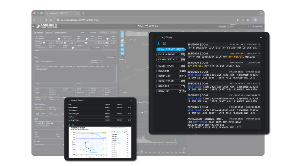
NOTAM Intelligence & Weight‑Balance
The NOTAM Intelligence module automatically ingests, analyzes and filters aeronautical notices by Q‑code, validity period and operational relevance, emphasizing critical constraints such as curfews and runway closures to enhance operational awareness. Weight and balance information is presented within the certified aircraft envelope, ensuring load configuration and mass distribution remain fully compliant with mission and airworthiness requirements.
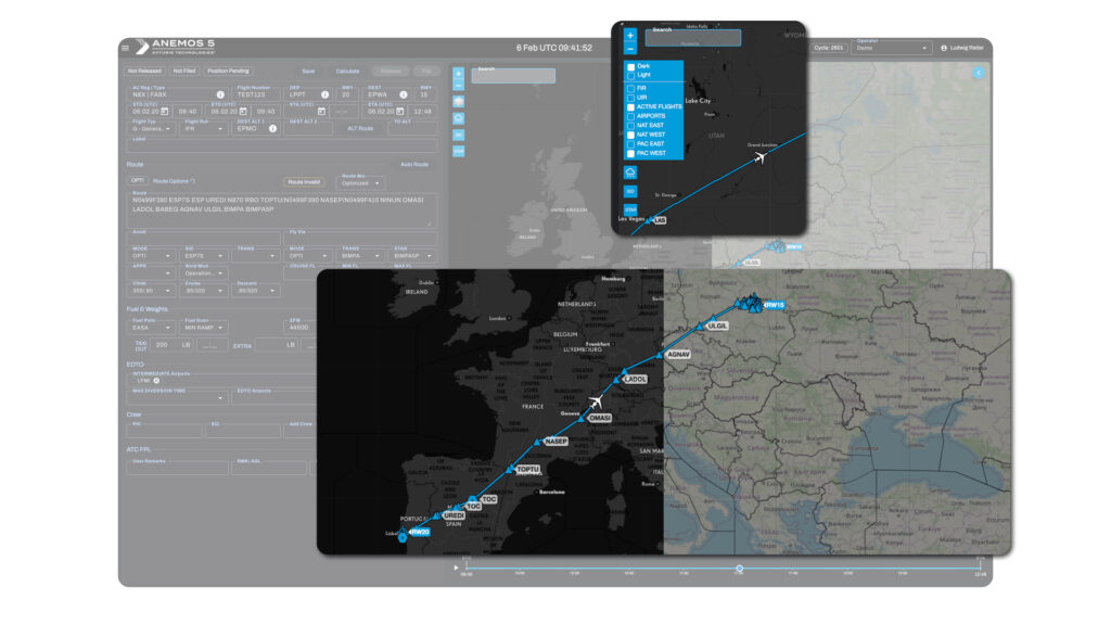
Mapping & Real‑Time Airspace Insight
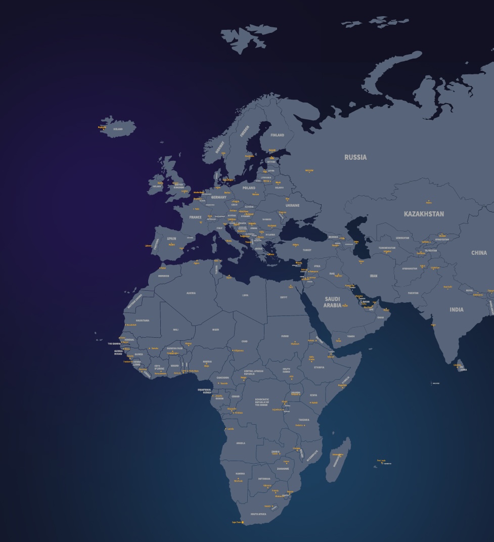
The map display supports light and dark modes and provides high‑resolution geographic and topographic detail, including FIR/UIR boundaries, aerodromes and real‑time North Atlantic (NAT) and Pacific (PAC) track information. Intelligent label zooming enhances readability across scales, while the own‑ship symbol is configurable to represent a broad range of aircraft types and mission profiles.
Three Additional Modules. One Unified Force Ecosystem.
RUNCAP – Runway Capability
The Runway Performance module delivers precise takeoff & landing calculations, incorporating weather, aircraft configuration and airport data to ensure compliant payload and structural limits.
- Native SCAP Interface
- MEL & Obstacle Automation
- Dynamic Rule Engine
AIRWATCH – Flight following
The Flight Following module provides continuous situational awareness through live tracking and automatic updates, ensuring deviations or delays are detected early for timely decisions.
- ADS-B, SATCOM & ARCAS
- WX, ATC & Diversion Monitoring
- RAG Flight Status Classification
EFB Mobile App
Our Mobile EFB app delivers critical operational data directly to the cockpit, providing pilots with real‑time insights, integrated performance data and digital compliance tools.
- Native Anemos 5 EFB
- Paperless, end‑to‑End Ops
- Live Flight & Compliance Data